Published May 5, 2022 03:08PM
Hike to the Top of Longs Peak in Rocky Mountain National Park
It's not a walk in the park.
Longs Peak as seen from Moraine Park in Rocky Mountain National Park (Photo: Shutterstock)
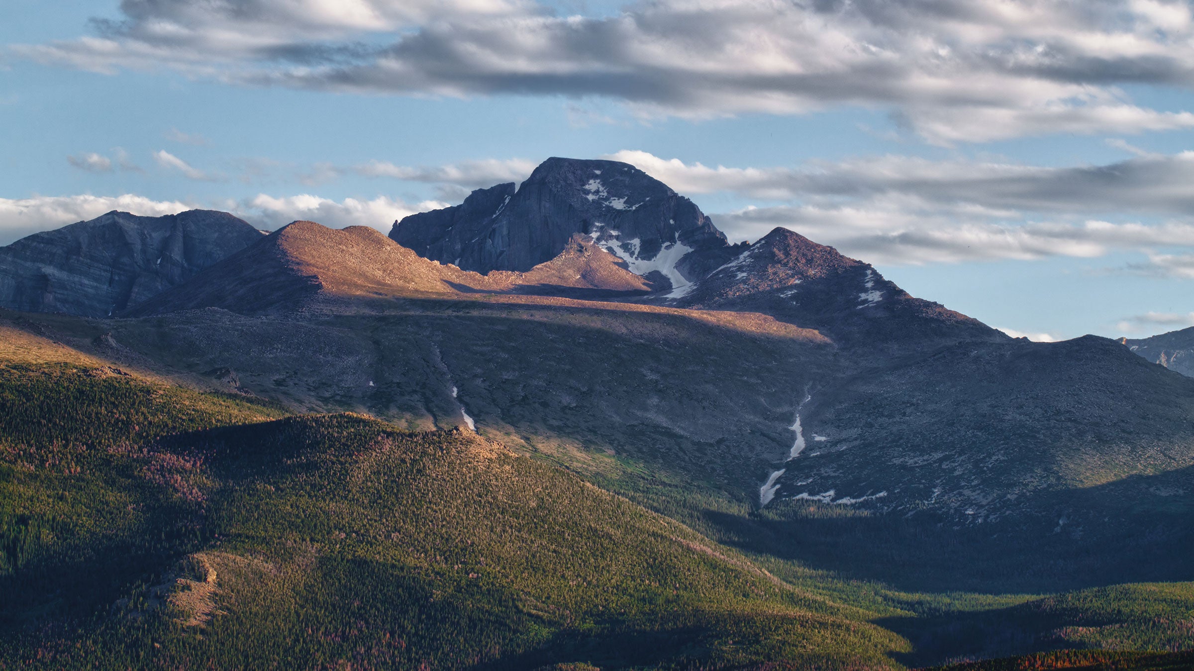
It is impossible to stare at the eastern skyline of Rocky Mountain National Park and not be compelled to at least wonder what it would be like to climb Longs Peak. Dominating the skyline, and topping out at 14,259 feet, Longs is the ultimate adventure for enthusiastic hikers.
Don’t be fooled though, it’s not a walk in the park. In fact, the 16-mile round trip hike will put hikers lungs and stamina to the test. The reward? Unobstructed 360-degree views spanning the eastern plains and continental divide. This route should only be attempted by advanced hikers who have experience on long routes at high altitude.
There are several routes to climb Longs Peak. The most popular and only non-technical route is the Keyhole, which will be described here.
Is Longs Peak Hard to Climb?
Longs Peak is hard to climb for multiple reasons. It’s a 16-mile hike, it takes you above 14,000 feet, so you have altitude and less oxygen to contend with and it is a steep uphill and downhill climb. Plus, you need to start early in the morning, pre-dawn, to avoid being on top or above tree line when the afternoon lightning storms roll in. Unless you’ve trained for climbing this peak or are extremely fit, it’s not a mountain we’d recommend trying to hike off the couch.
ADVERTISEMENT
Two rules come into play when hiking Longs: Start early and drink more water than you think necessary. When planning an assent, try to organize it so you can hike during the tail end of your trip. The few days of being in the park will help your body acclimate to the high altitude.
Longs Peak Trailhead
The journey starts from the Longs Peak Trailhead located along CO-7 10.2 miles from Estes Park. Most hikers typically begin several hours before dawn, since afternoon thunderstorms usually roll in around noon or 1 p.m. and can be life threatening above tree line.
The first two miles gain steady elevation while passing through Goblin’s Forest. After crossing several small streams, the trail emerges from the trees and crosses into open tundra. Time this right and the sun will just be peaking out across the eastern horizon. Looking ahead you will now be able to see Longs looming in dawn light.
Chasm Lake Trail Junction
The trail continues to gain elevation while feeding through open tundra filled with jagged rocks and boulders lit by the early morning sunrise. At Chasm Lake Trail Junction, grab a quick snack and soak in views of Longs 18-acre granite face known as the Diamond. The face can be climbed by experienced climbers.

After the junction, follow the trail gaining steady amounts of elevation while wrapping around a small ridgeline. The hike then enters the boulder field, a large relatively flat field of boulders where a few backcountry campsites reside. The infamous keyhole, which leads to the only non-technical route up Longs Peak, is now visible directly ahead at the top of the boulder field.
ADVERTISEMENT
The Keyhole
Before passing through the keyhole, check for storm clouds building on the horizon. Past this point the trail is fully exposed and can be dangerous if a thunderstorm rolls in. Always remember to err on the side of caution and heed a hikers well-known saying: the mountain is not going anywhere; it will be here another day.
Pass through the keyhole and begin a final mile-long ascent to the summit. To navigate, follow spray painted targets to the base of a long trough. As you ascend the trough, don’t forget to turn around for some of the best views in the Park of Glacier Gorge to the North.
ADVERTISEMENT
The large flat summit of Longs has unobstructed 360-degree views of the eastern plains, Indian Peaks Wilderness to the south, and the Rocky Mountain National Park to the west. To return, retrace your route back to Longs Peak Trailhead.
Note: If you start to feel nauseous, it’s probably a resort of high altitude. Start heading back down to lower elevations where the symptoms should reside. If they persist, it’s best to seek a doctor.

Need a Detailed Trail Map for Longs Peak?
Download our favorite hiking app, GAIA GPS, to build your route, download maps for offline use, see when the trail is snow-free and more. Or, buy the Rocky Mountain National Park Trail Map Pack including Longs Peak at REI.com
For answers to the most frequently asked questions about climbing Longs Peak, visit www.nps.gov/romo/planyourvisit/longs_peak_faq.htm.