Published July 15, 2020 06:37PM
3-Mile Trail to Deer Mountain Peak in Rocky Mountain National Park
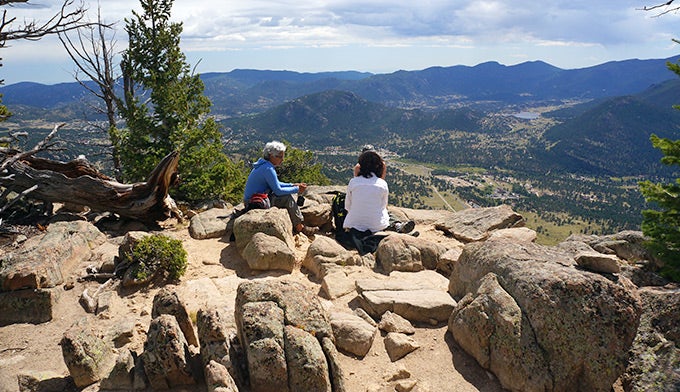
There are gorgeous views all the way along the trail and a 300-degree view as your reward for reaching the top.
'Gloria Wadzinski'
Easiest Peak to Summit in the Park Yet Still Challenging
Deer Mountain is a 10,013 foot peak in the northeastern part of Rocky Mountain National Park. Hard-core climbers and hikers might scoff at the mini-mountain next to Colorado’s 14’ers (mountains that are higher than 14,000 feet in elevation), but it’s a nice challenge for vacationers and people who want a day hike at the park. Be sure to touch the summit marker at the top to officially “bag the peak.”
Plan on two to three hours to get to the top, and an hour and a half to get back down. As an option to returning to the trailhead, the trail can be extended another four and a half miles down the back side to end the hike in Estes Park.
Deer Mountain Trailhead Parking
The trailhead is on Trail Ridge Road with parking on the side of the road. Since parking is limited, and the shuttle bus does not take you to this trailhead, it is best to get there early.

The 3-mile trail starts with a 1-mile meander through open valley. Then, the trail enters a steep forested area with eight switchbacks that make the climb easier. The third mile starts with a slight downward slope through an aspen forest, and then the final two-tenths of a mile are steep stone steps that take you up to your total elevation gain of around 1,000 feet. There are gorgeous views all the way along the trail and a 300-degree view as your reward for reaching the top.
ADVERTISEMENT
Also watch for wildlife along the trail. These photos are from a September hike where we saw bull elk bugling and guarding their harems. You may also see many deer, chipmunks and marmots. Small critters will beg for food, but please don’t feed them.
Since two-thirds of the trail is shady forest, it can stay peppered with snow into June. If you are doing a spring hike, bring trail crampons or microspikes.


Download an official Rocky Mountain National Park map for basic road and attraction locations. Want a detailed topographical map of trails in the park? Buy the National Geographic Trails Illustrated Map for Rocky Mountain National Park at REI.com. The map includes trails, trailheads, points of interest, campgrounds, lakes and much more. Or get the Trails Illustrated Rocky Mountain National Park Day Hikes map with 16 detail maps, trail mileages and difficulty ratings. Both maps are printed on waterproof, tear-resistant material.
If you buy from shopping links on this website, National Park Trips may receive an affiliate commission.