Published December 11, 2021 09:21AM
3 Scenic Drives in Black Canyon of the Gunnison National Park
Dramatic canyon walls, incredible sunset views and a sense of solitude await.
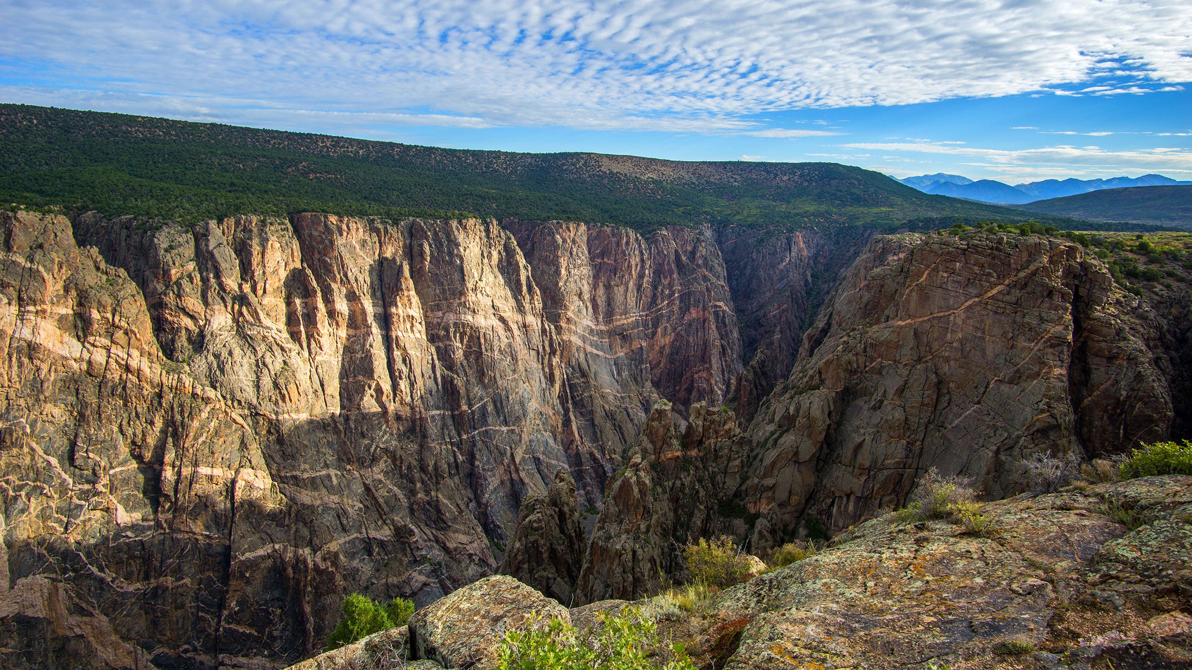
Black Canyon of the Gunnison National Park (Photo: Flickr/Mcfst3)
Black Canyon of the Gunnison National Park is an often-underrated national park site in western Colorado. Formed by the Gunnison River over the last 15 million years, this gorgeous canyon has sheer, black-striped walls that plunge down to the water below. Here is how to explore this stunning park with three scenic drives plus road-trip advice.
Since it’s a canyon, the park has two distinct sides. From each rim you can easily see the other, but by car it takes two hours to get between them. The South Rim is the most visited and is home to the park’s visitor center and a reservable campground. If you want to drive down to the river, the East Portal Road is also located on the South Rim.
The North Rim is more remote. It has an intermittently open ranger station and unpaved roads, but if you’re after a sense of solitude, this is the place to go.
South Rim Drive
South Rim Drive is the main road to access all the viewpoints and hiking trails on the park’s South Rim. From the entrance station to the end of the road is 7.2 miles. While this might not seem like a huge distance, remember that park speed limits are lower than normal roads. With 12 viewpoints to stop at, the drive will also take longer than you might imagine.
ADVERTISEMENT
To get to the entrance station from Montrose, take Hwy. 50 east to CO 347. From here, it’s approximately a 10-minute drive to the park.
It’s worth stopping at all 12 viewpoints since they each offer a different perspective of the canyon. Most are very short walks from the parking area to the view. If you’re short on time, we suggest Gunnison Point, Pulpit Rock, Chasm View, Painted Wall and Sunset View. All viewpoints are on the right side of the road when heading into the park, making it easy to pull-off on your way in and avoid stopping for other cars pulling out on your way back.
The visitor center is located at Gunnison Point and is a great place to stop at to learn more about the park. From there, it’s a short walk to the fenced overlook where you’ll be on a rock point with cliffs dropping off on either side. In the winter, the road is closed past Gunnison Point.
ADVERTISEMENT
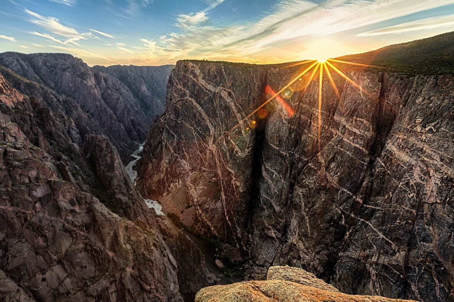
From Pulpit Rock, one of three handicapped accessible overlooks, you’ll get an incredible view across the canyon to the North Rim. Painted Wall features some of the most interesting views of the colors and patterns of the canyon walls. Chasm View is a great spot to peer down at the Gunnison River far below and is handicapped accessible. If you can time it right, Sunset View is one of the best places in the park to take in the daily show of the sun setting over the canyon, bathing everything in orange light. Bonus points, it’s handicapped accessible.
East Portal Road
East Portal Road is the only way to drive to the river at the bottom of the canyon. If you’re traveling in an RV, this scenic drive isn’t for you. With a 16% grade, this engineering marvel is very steep and has lots of switchbacks and vehicles more than 22 feet in length aren’t allowed. This road is closed typically from November to April.
At just over 7 miles from the entrance station, this paved road will give you a unique perspective as you descend into the canyon. Pick up a brochure at the visitor center before you start the drive and learn about the town of East Portal and the tunnel that was built to turn arid Montrose into fertile farmland.
ADVERTISEMENT
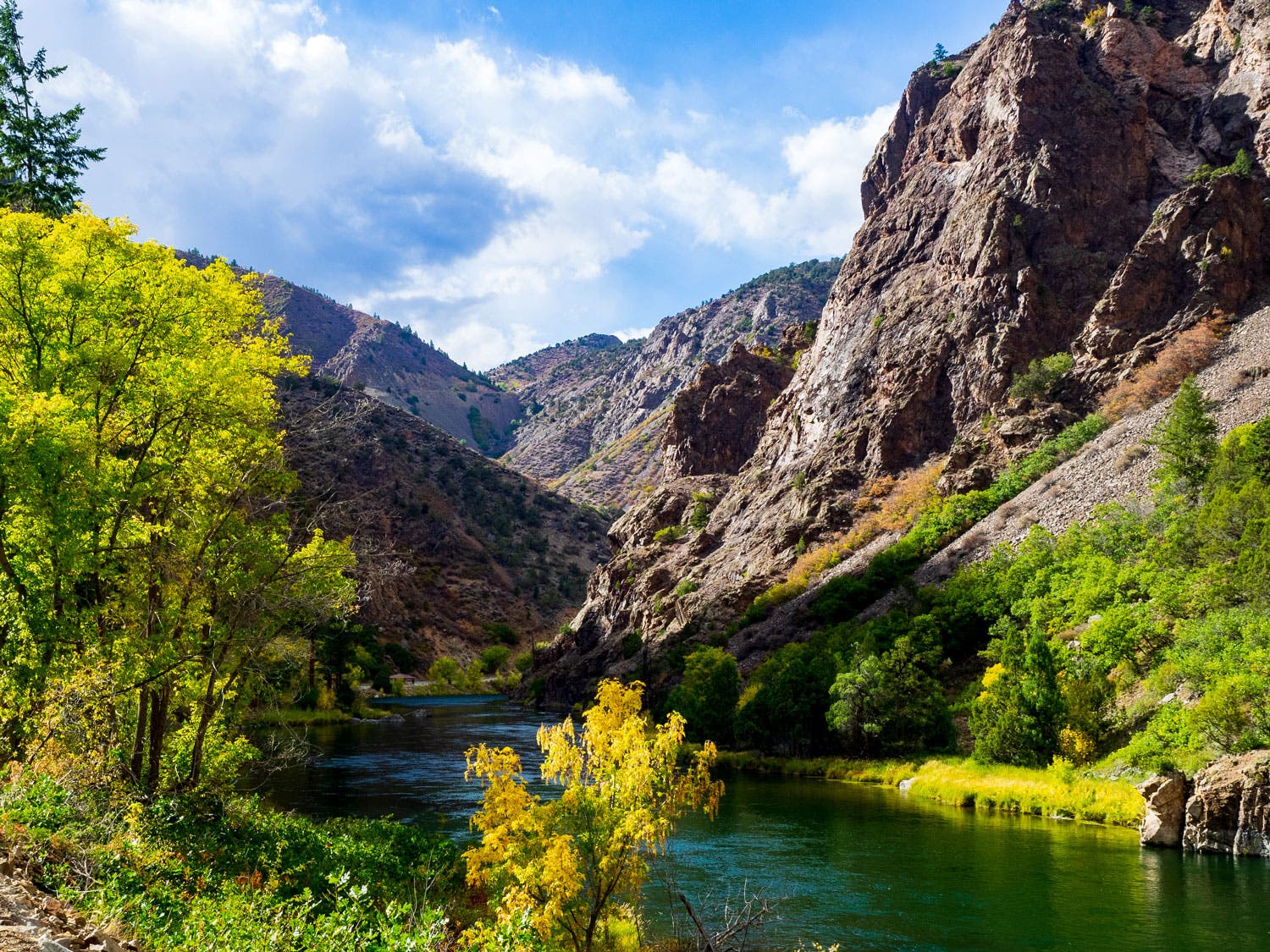
At the bottom of the canyon, you’ll find a calm section of the Gunnison River perfect for fishing, the East Portal Campground (which is first-come, first-served) and the Crystal Dam.
North Rim
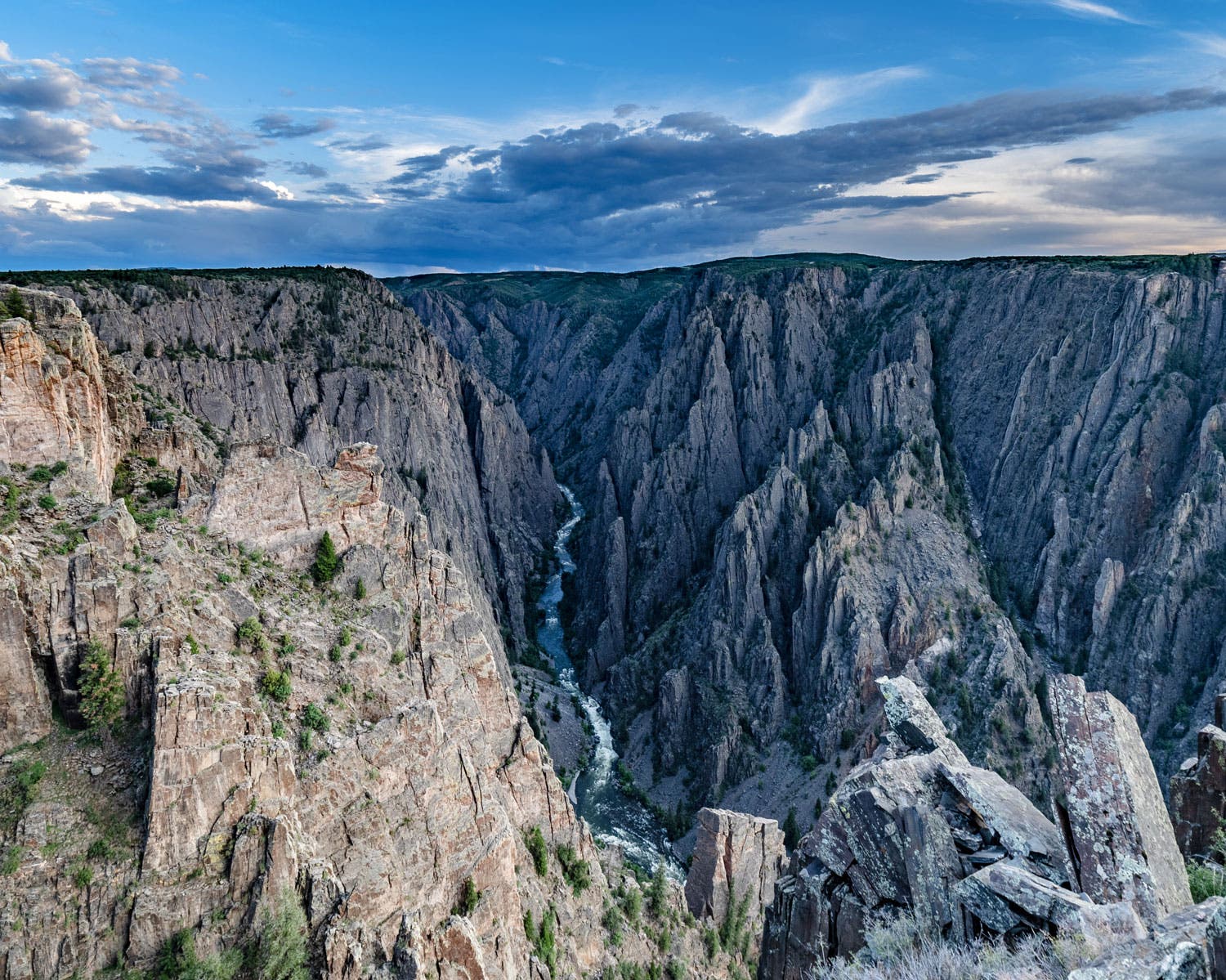
The views are what draw many to the North Rim. Here, the canyon walls are almost perfectly vertical, making the views incredibly dramatic.
The closest town to the remote North Rim is Crawford. From the South Rim, you can access the North Rim by either going around the west side or the east side of the park. While the drive east is a bit more scenic, passing along the Curecanti National Recreation Area, the drive west is shorter and has fewer switchbacks. Either way takes approximately two hours.
ADVERTISEMENT
The unpaved North Rim Road (G74 Road) is approximately four miles from where it intersects with Black Canyon Road, which is also unpaved for the last few miles. The roads are gravel and usually passable by most cars but it’s always a good idea to check with a ranger on road conditions before heading out. This road is closed in the winter.
Stop at all five overlooks along North Rim Road: The Narrows, Balanced Rock, Big Island, Island Peaks and Kneeling Camel.
Four Road Trip Tips
1. Check Your Battery
Before your road trip, check your battery’s charge. Heat saps its strength, so make sure you have a full charge, especially driving through national parks.
2. Inflate Your Tires
Avoid a tire blowout or wasting gas mileage by inflating each tire to your car’s recommended tire pressure. That number is usually located in your car’s owner’s manual or on a sticker inside your passenger door.
ADVERTISEMENT
3. Examine Your Treads
Stick a penny in a tire tread with Lincoln’s head upside down. If you can see his whole head, you need new tires. The shallower the tread, the less responsive your tires are to wet, snowy or icy conditions.
4. Have a Spare
Pack a spare tire and make sure it’s properly inflated and has solid tread depth.