Updated June 13, 2025 12:12AM
Official Black Canyon of the Gunnison National Park Map PDF
'NPS' (Photo: NPS)
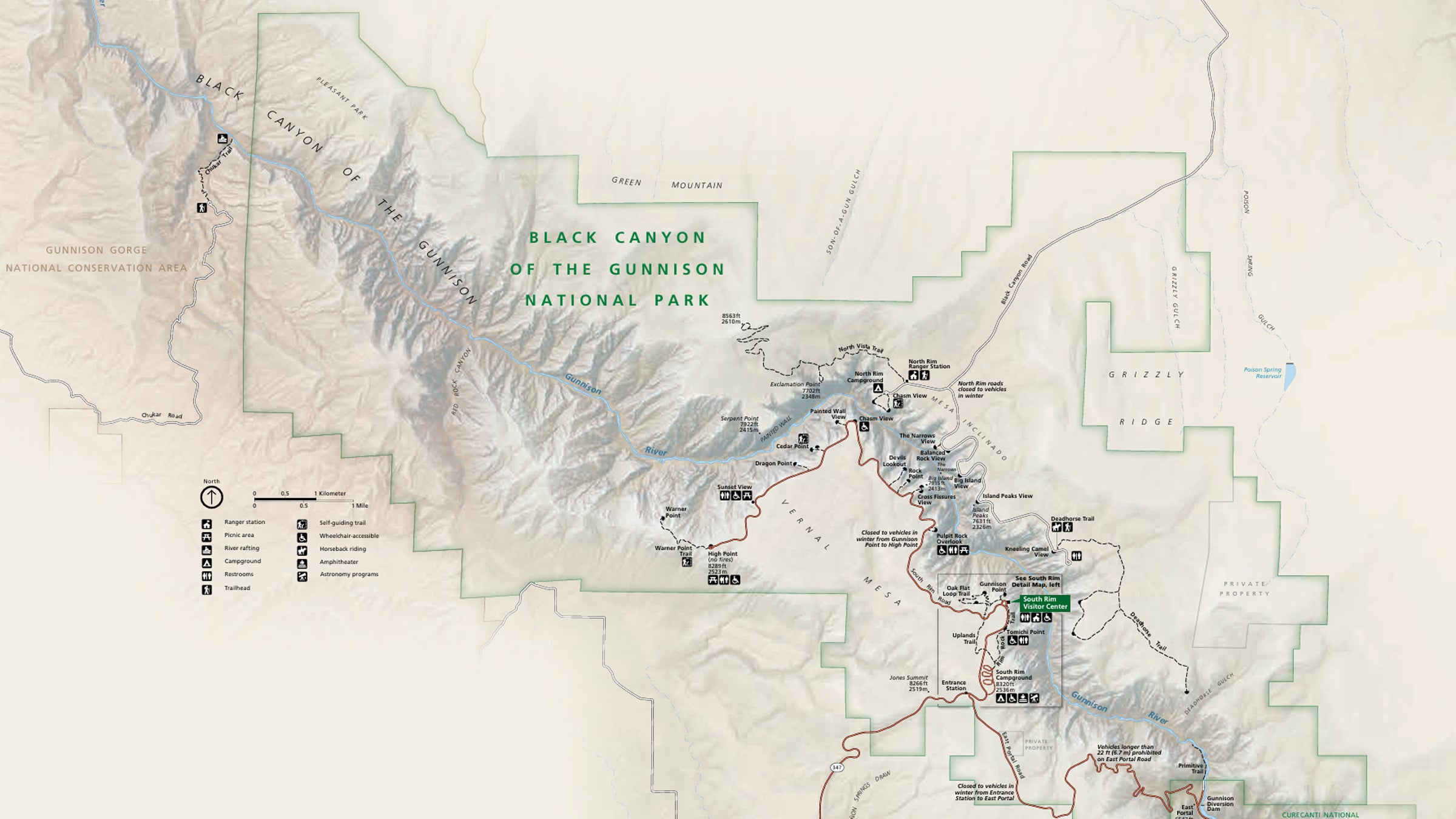
Download Black Canyon of the Gunnison Map PDF
Download the official map to find your way around Colorado’s Black Canyon including park roads, trails, visitor center, and popular overlooks such as Painted Wall and Sunset View.
Note that there are two entrances. The North Rim Road is closed in winter and receives fewer visitors than the popular South Rim Road. Also on the south side is the East Portal Road which is closed in winter.
See where campgrounds are located. There are also picnic areas, public restrooms, an amphitheater, and trails with handicap access in the park.
ADVERTISEMENT
Need a Detailed Topographic Map for the Park?
Buy the National Geographic Trails Illustrated Map for Black Canyon of the Gunnison National Park at REI.com. The map notates trails, trailheads, points of interest, campgrounds, river access and much more printed on waterproof, tear-resistant material. Coverage also includes Gunnison Gorge National Conservation Area, Blue Mesa Reservoir, parts of Gunnison National Forest and West Elk Wilderness, Montrose, Paonia and Hotchkiss.
If you buy from shopping links on this website, National Park Trips may receive an affiliate commission.